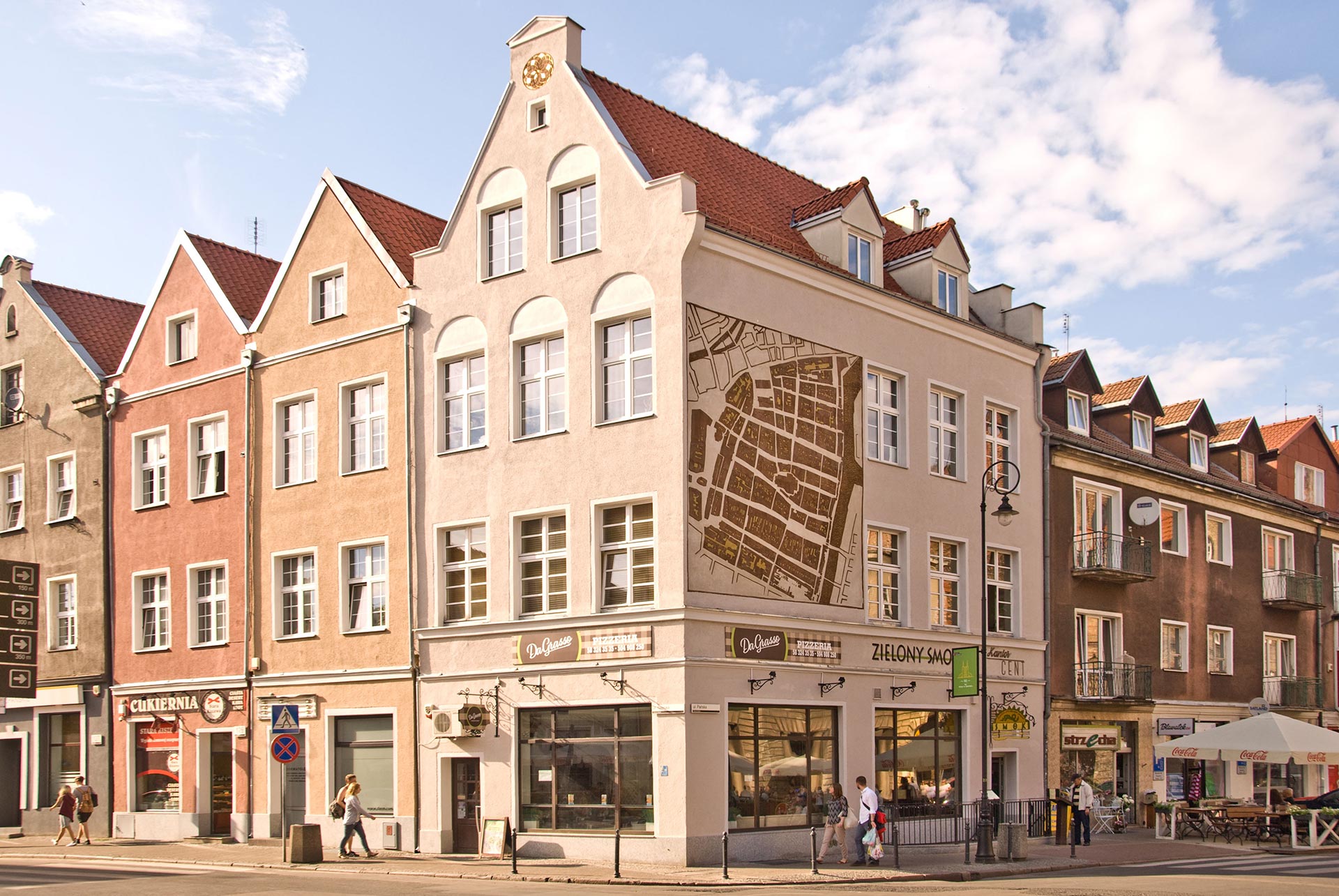
Since recently, on the side wall of the tenement at the corner of Węglarska and św. Ducha Streets in Gdańsk you can see a mural made in sgraffito technique depicting a fragment of the famous Buhse’s Plan, demonstrating the area of the Main Town. The prototype of the plan was drawn up by Daniel Buhse in 1863-1868. It served for administrative and judicial purposes as a cadastral plan. It was made on eighteen limestone boards, on which it was reflected on paper copies using the lithographic technique. This plan is a valuable historical document, as it portrays in the smallest detail the exact scheme of streets and buildings of Gdańsk from 150 years ago, including every smallest house, annexe, alley and yard within the historic downtown. For this reason, it was used in the reconstruction of the city, and until today it has been constantly helpful in conducting archaeological research, as it literally provides an indication of what archaeologists might discover in the area of old Gdańsk once they go underground.